
Paper Maps vs. GPS Navigation: What Serious Road Trippers Actually Use
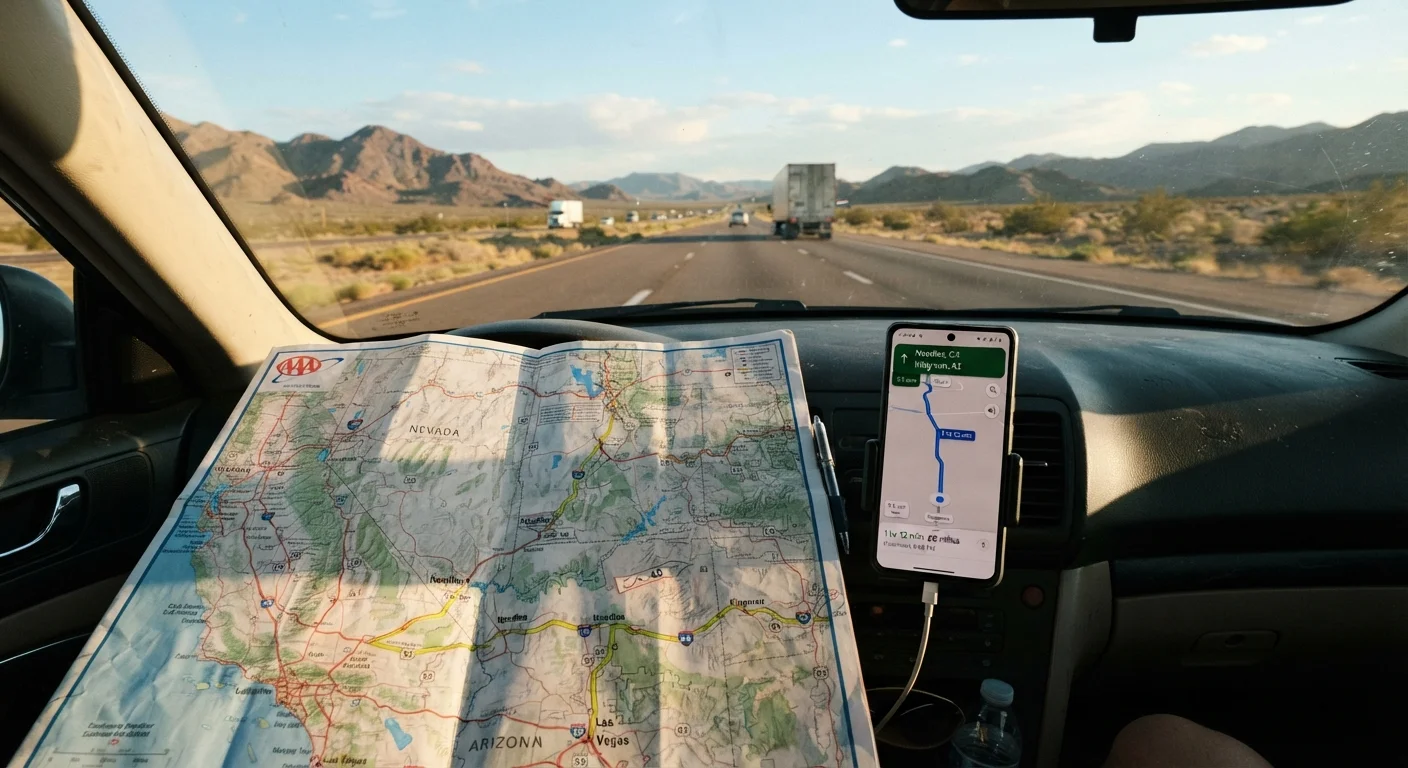
Photo credit: faqsnest.com
In this article
Digital nav is convenient, but paper maps have genuine advantages off the grid. A practical look at when each approach earns its place in the car.
Key Takeaways
- GPS navigation excels in urban areas and real-time traffic routing but depends on signal and battery life.
- Paper maps never lose signal, cover remote areas comprehensively, and help drivers build genuine spatial awareness.
- Serious road trippers often carry both — GPS for daily navigation, paper maps as a reliable backup.
- Offline map downloads can bridge some gaps, but they don't fully replace a physical atlas in dead zones.
- Choosing between them depends heavily on your route, destinations, and tolerance for tech dependency.
Real-time traffic rerouting saves significant time
GPS apps pull live traffic data and suggest alternate routes around accidents or construction automatically, something no paper map can do on the fly.
Voice guidance reduces distraction while driving
Audible turn-by-turn directions let drivers keep eyes on the road rather than consulting a printed map, which improves safety in complex or unfamiliar areas.
Constantly updated points of interest and road data
Digital maps reflect new road openings, business closures, and fuel station locations more quickly than annually printed atlases.
Compact and always with you on a smartphone
A phone with navigation installed adds no bulk to the vehicle and requires no extra packing consideration, unlike a large-format road atlas.
Offline map downloads extend usability into low-signal areas
Pre-downloaded regional maps allow basic routing even without a cell connection, narrowing — though not eliminating — the coverage gap.
Completely useless without signal or battery power
Large stretches of the American West, national parks, and rural corridors have no reliable cell coverage, leaving GPS-dependent drivers effectively blind without a backup.
Encourages passive navigation over spatial awareness
Following turn-by-turn prompts without understanding the broader route means drivers often can't course-correct intelligently when the app fails or gives poor guidance.
Prone to outdated or inaccurate rural road data
Remote Forest Service roads, reservation routes, and newly reclassified highways sometimes appear incorrectly or not at all in digital databases, even with recent map data.
Technology dependency creates a single point of failure
A cracked screen, dead battery, or software crash eliminates navigation entirely if the driver hasn't prepared a non-digital backup.
Why This Debate Still Matters
Smartphone navigation has made turn-by-turn directions the default for most American drivers. Yet a growing number of road trippers — particularly those heading into the rural West, the desert Southwest, or remote stretches of Appalachia — are rediscovering the case for paper maps. This isn't nostalgia. It's practicality.
If you're planning a multi-day route across America, your navigation setup deserves the same careful thought as your vehicle prep and packing list. The right tool depends entirely on where you're going and what could go wrong.
The Case for GPS Navigation
Digital navigation — whether through a dedicated GPS unit or a smartphone app — has real advantages that paper simply can't match in everyday conditions.
Real-time traffic rerouting saves significant time
GPS apps pull live traffic data and suggest alternate routes around accidents or construction automatically, something no paper map can do on the fly.
Voice guidance reduces distraction while driving
Audible turn-by-turn directions let drivers keep eyes on the road rather than consulting a printed map, which improves safety in complex or unfamiliar areas.
Constantly updated points of interest and road data
Digital maps reflect new road openings, business closures, and fuel station locations more quickly than annually printed atlases.
Compact and always with you on a smartphone
A phone with navigation installed adds no bulk to the vehicle and requires no extra packing consideration, unlike a large-format road atlas.
Offline map downloads extend usability into low-signal areas
Pre-downloaded regional maps allow basic routing even without a cell connection, narrowing — though not eliminating — the coverage gap.
Real-time traffic rerouting alone can save hours on busy interstates. Construction detours, accident closures, and unexpected congestion are handled automatically. For urban legs of a road trip, that responsiveness is genuinely hard to replicate with a paper map and guesswork.
GPS also handles complex highway interchanges and unfamiliar city grids with minimal cognitive load, letting drivers keep more attention on the road. Voice-guided directions reduce the temptation to glance at a map while moving — a meaningful safety benefit.
The Case for Paper Maps
Paper maps have limitations that are easy to dismiss until you hit a canyon with no cell signal 200 miles from the nearest town.
Completely useless without signal or battery power
Large stretches of the American West, national parks, and rural corridors have no reliable cell coverage, leaving GPS-dependent drivers effectively blind without a backup.
Encourages passive navigation over spatial awareness
Following turn-by-turn prompts without understanding the broader route means drivers often can't course-correct intelligently when the app fails or gives poor guidance.
Prone to outdated or inaccurate rural road data
Remote Forest Service roads, reservation routes, and newly reclassified highways sometimes appear incorrectly or not at all in digital databases, even with recent map data.
Technology dependency creates a single point of failure
A cracked screen, dead battery, or software crash eliminates navigation entirely if the driver hasn't prepared a non-digital backup.
Beyond the dead-zone problem, paper maps offer something digital navigation quietly erodes: spatial understanding. When you study a map before a trip, you internalize the shape of your route — which direction the mountains run, where rivers cross, how far towns are spaced apart. That mental model helps you make better decisions when conditions change.
~30%
U.S. land area with limited or no cell coverage
FCC coverage maps and independent audits consistently show substantial portions of rural and wilderness America have unreliable or absent mobile data service.
1 in 4
Drivers who've been misrouted by GPS
Consumer surveys on navigation reliability regularly find a significant minority of drivers report GPS errors sending them onto wrong roads, closed routes, or dangerous shortcuts.
A current road atlas — updated annually by publishers — covers secondary roads, national forest routes, and tribal lands that sometimes lag in digital databases. For adventurous routes that dip onto Forest Service roads or rural state highways, a physical map can be more reliable than a downloaded tile set.
For a broader look at how the American road trip comes together from planning to arrival, navigation is just one piece of a larger preparation puzzle.
Offline Maps: A Middle Ground Worth Understanding
Most major navigation apps now allow users to download regional maps for offline use, which addresses the dead-zone problem to a degree. Downloaded maps provide turn-by-turn routing without a live data connection, and they're genuinely useful on routes where signal is intermittent rather than completely absent.
Offline Maps Still Need Preparation
Downloading offline maps before departure is a smart move, but it requires planning. Most apps limit download regions by geographic area, so a cross-country route may require multiple downloads. Storage space on your device can also become a constraint. Check download freshness before leaving — offline tiles don't auto-update the way live maps do, and an outdated download can still mislead you on recently changed roads.
That said, offline maps don't update in real time and can miss newly constructed roads or altered routes. They also require forethought — you need to download the right regions before you leave, and large downloads can take significant storage space on a phone. They're a strong complement to GPS, but not a full substitute for the reliability of print.
What Road Trippers Actually Do
Among drivers who regularly tackle long-haul American road trips, the most common practical approach is to carry both. A GPS-enabled device or app handles the daily navigation load. A road atlas — kept in the door pocket or glove compartment — serves as the backup and the planning tool.
Before each driving day, spending five to ten minutes with the paper map gives you a clear sense of the corridor ahead: fuel stop spacing, elevation changes, alternate routes if a road closes. That orientation pays dividends when you're deep in rural Montana and your phone decides it's done for the day.
The key is not letting either tool become a single point of failure. Charge cables break, apps crash, and paper maps can be left at the gas station. Redundancy is the road tripper's friend.

Author
Cars & Driving Editorial Team
Cars & Driving Editorial Team is the collective byline for our editorial team and contributor network. Articles published under this byline or an editorial pen name are researched, written, and reviewed according to our editorial standards for clarity, consistency, and independence before publication.
View all articles →