
Scenic Routes Worth Taking Instead of the Interstate
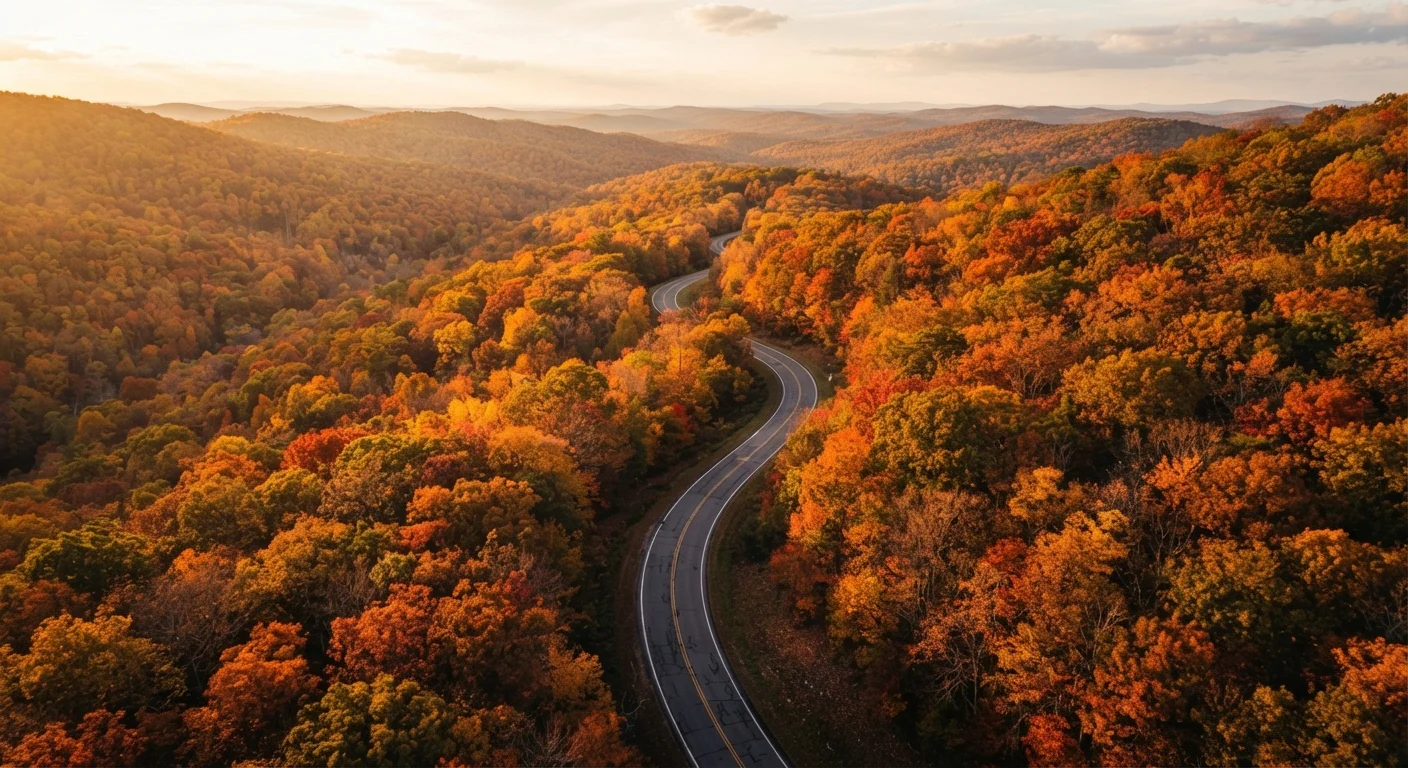
Photo credit: faqsnest.com
In this article
Historic byways, coastal highways, and mountain roads that trade speed for scenery — with notes on what makes each stretch worth the detour.
Key Takeaways
- Scenic byways often add only 30–90 minutes to a trip while delivering dramatically better experiences.
- Many of America's most celebrated roads are federally designated All-American Roads or National Scenic Byways.
- Slower roads demand more driver attention — especially on mountain grades and coastal cliffs.
- Fuel stops and cell coverage can be sparse on remote scenic routes; plan accordingly.
- Seasonal conditions significantly affect road access and scenery on many of these routes.
Why the Slow Road Is Worth It
Interstate highways are engineering achievements, but they were designed to move freight and commuters efficiently — not to connect you with the American landscape. The exits blur together, the scenery flattens out, and 400 miles can feel like four hours of the same view on repeat.
Scenic routes fix that. Whether you're threading along the Pacific coastline, climbing through the Smokies, or crossing high desert plains, these roads ask something different of you as a driver: attention, patience, and a willingness to stop. The payoff is genuine — roadside vistas, small-town diners, and the feeling that you actually passed through somewhere rather than over it.
If you're already thinking through a longer journey, the multi-day road trip planning guide covers how to build these slower stretches into a realistic schedule without turning your trip into a logistics headache. The routes below are a solid starting point for what to put on the map.
Download Maps Before You Leave
Cell coverage on many scenic routes — especially through national parks and remote mountain corridors — is unreliable or nonexistent. Download offline maps for your route in advance using a navigation app that supports it. A paper state map or atlas as a backup is old-fashioned advice that still holds up.
Routes Worth Pulling Off the Interstate For
Pacific Coast Highway (California Highway 1)
Few roads in North America match the drama of California's Highway 1 between San Luis Obispo and Carmel. The route hugs cliffs above the Pacific, passes through Big Sur's redwood-flanked canyons, and crosses the iconic Bixby Creek Bridge. On clear days, the ocean stretches to the horizon without obstruction.
The tradeoff: this road demands your full attention. Lanes are narrow, pullouts can be short, and blind curves don't forgive distracted driving. Rockslides and storm damage also periodically close sections — always verify current conditions before heading out. Cell coverage drops significantly through Big Sur.
Northbound driving gives the passenger-side ocean views; southbound keeps the driver closer to the cliff edge. Plan for 3–4 hours to cover the Big Sur stretch alone if you stop, which you will.
Highway 1 through Big Sur is among the most visually dramatic drives in North America — and demands full driver attention.
Blue Ridge Parkway (Virginia and North Carolina)
The Blue Ridge Parkway runs 469 miles from Shenandoah National Park in Virginia to Great Smoky Mountains National Park in North Carolina. The speed limit tops out at 45 mph — by design. This is a road built for looking, and it delivers: ridge-top vistas, hardwood forests, and access to dozens of hiking trails and historic overlooks.
Fall foliage season (roughly mid-October through early November) draws heavy traffic, but the colors justify it. The road is also periodically closed in winter due to ice and snow on the higher elevations, so check seasonal status before planning a cold-weather trip. There are no commercial vehicles permitted, which keeps the road quiet and the experience consistent.
The Blue Ridge Parkway's 45 mph limit isn't a frustration — it's the whole point.
Going-to-the-Sun Road (Montana)
Crossing the Continental Divide through Glacier National Park, Going-to-the-Sun Road is a 50-mile route that climbs to Logan Pass at 6,646 feet. The engineering alone is remarkable — carved into mountainsides in the 1920s and 30s, the road passes through alpine meadows, past glaciers, and along sheer drop-offs with guardrails that feel modest given the exposure.
Vehicle size restrictions apply: vehicles over 21 feet (including tow equipment) or wider than 8 feet are prohibited on the central section. The road typically opens fully in late June and closes by mid-October, weather permitting. Arrive early — parking at Logan Pass fills well before midday during peak summer weeks.
Vehicle length and width restrictions apply on Going-to-the-Sun Road — check before you go.
Natchez Trace Parkway (Tennessee, Alabama, Mississippi)
The Natchez Trace Parkway follows a 444-mile historic travel corridor used for thousands of years by Native Americans, European settlers, and 19th-century boatmen returning home from New Orleans. The modern parkway is managed by the National Park Service, and like the Blue Ridge Parkway, it prohibits commercial vehicles and limits speeds to 50 mph.
The scenery here is quieter than the mountain routes — rolling forests, cypress swamps, Native American mounds, and preserved historic sites. It's a better fit for drivers who want history alongside the landscape. The southern terminus in Natchez, Mississippi is worth spending time in before or after the drive.
The Natchez Trace layers thousands of years of American history beneath a canopy of quiet forest road.
US Route 89 (Arizona and Utah)
Running from Flagstaff, Arizona north through Page and on into southern Utah, US-89 strings together some of the Southwest's most striking geology. You'll pass near the Vermilion Cliffs, cut through the Grand Staircase-Escalante region, and approach iconic formations that feel unreal from the road.
This is high-desert driving: summer heat can be extreme, services are widely spaced, and the elevation shifts significantly as you move north. Carry water well beyond what you think you'll need, and keep your fuel tank topped off. The reward is a landscape that genuinely looks like another planet — wide, ancient, and almost entirely free of interstate noise.
US-89 through the Southwest demands heat preparation and extra water — the scenery is well worth it.
US Route 2 (Montana — the Hi-Line)
Stretching across northern Montana roughly parallel to the Canadian border, US-2 is one of the least-traveled scenic routes on this list and one of the most rewarding for drivers who prefer solitude. The route passes through Glacier County, skirts the southern edge of Glacier National Park, crosses the Blackfeet Reservation, and rolls through small agricultural towns before entering the wide-open prairies heading east.
Distances between gas stations can exceed 50 miles in places. Winter weather hits early and hard in this corridor. But for drivers who want to understand the sheer horizontal scale of the American West without tourist infrastructure getting in the way, the Hi-Line is difficult to match.
US-2 across northern Montana is one of the most remote scenic routes in the lower 48 — plan your fuel stops carefully.
These stretches represent a range of terrain, regions, and difficulty levels. Some are well-known; others reward drivers who do a little homework in advance. Before committing to any remote route, check current road conditions, seasonal closures, and your vehicle's suitability — particularly for high-elevation or unpaved sections. The guide to driving unfamiliar terrain is worth reading before you tackle the steeper or more exposed stretches on this list.
Making the Most of the Detour
Scenic routes reward preparation more than interstates do. Gas stations, fast food chains, and cell towers aren't guaranteed every 20 miles. A full tank before you leave a town, downloaded offline maps, and a rough sense of where the next services are can prevent a beautiful drive from turning stressful.
Budget your time honestly. Twisting mountain roads and coastal two-lanes rarely allow the speed averages you'd hit on a highway. A 60-mile scenic stretch might take 90 minutes or more, especially with stops. Underestimating this is one of the most common ways road trips fall behind — something the breakdown of road trip scheduling mistakes examines in useful detail.
First-time solo drivers in particular should read up before heading into unfamiliar or remote terrain. The solo road trip primer has practical guidance on staying safe and confident when you're navigating alone. And if you want a single resource that covers the whole picture — from route picking to arrival — the complete American road trip guide is a good place to anchor your planning.
The interstate will always be there for when you need to cover ground fast. But for the drives you'll actually remember, the slower road usually wins.

Author
Cars & Driving Editorial Team
Cars & Driving Editorial Team is the collective byline for our editorial team and contributor network. Articles published under this byline or an editorial pen name are researched, written, and reviewed according to our editorial standards for clarity, consistency, and independence before publication.
View all articles →